The Green Plan Studio as a Bridge between Landscape Education and Practice in Tunisian Cities
ABout the Author/s



Cet article étudie comment l'enseignement de l'architecture du paysage en Tunisie peut évoluer d'une conception conventionnelle d'espaces verts isolés vers une infrastructure verte connectée, à travers l’atelier Plan Vert à l'ISA-CM. Dépassant les simples critères quantitatifs, cet atelier constitue un laboratoire pédagogique où les étudiants pratiquent l'apprentissage par l'action dans plusieurs villes tunisiennes. À travers l'analyse paysagère, le diagnostic SWOT et des plans d'action, les étudiants réévaluent les espaces sous-utilisés, friches, terrains vagues et franges agricoles, pour concevoir des réseaux verts multifonctionnels. Cette méthodologie adaptable offre un cadre guidé par le projet, reliant la formation académique à la planification territoriale et à la résilience urbaine.
This article examines how landscape architecture education in Tunisia can transition from traditional, isolated green spaces to connected green infrastructure using the Green Plan Studio at ISA-CM. Moving beyond purely quantitative metrics, the studio serves as a pedagogical laboratory where students learn by doing across several Tunisian cities. Through landscape assessment, SWOT analysis, and action planning, students re-evaluate underused spaces, such as brownfields, vacant land, and agricultural fringes, to design connected, multifunctional green networks. Ultimately, this methodology offers an adaptable, design-led framework that bridges academic learning with real-world territorial planning and urban resilience.
Introduction
How can landscape architecture education contribute to more resilient, inclusive and adaptive African cities? In Tunisia, the challenge is not simply a lack of urban green spaces. In some cities and neighbourhoods, green space may appear quantitatively sufficient, yet its quality, accessibility, functionality and spatial distribution remain problematic. Green spaces can be concentrated in affluent neighbourhoods, coastal areas or tourist zones, while other districts remain poorly served. Such uneven distribution can reinforce socio-spatial inequalities by making access to environmental quality and landscape amenities dependent on where people live.
This raises a fundamental question: is the amount of green space sufficient to assess the quality of a city’s green system? This question also resonates with the paradoxes surrounding the production and perception of urban greenness, where the presence of vegetation does not necessarily translate into equitable access, environmental quality or social benefits (Doherty, 2017). A more landscape-led approach must also consider where green spaces are located, who can access them, how they function, and how they connect to other ecological and urban systems.
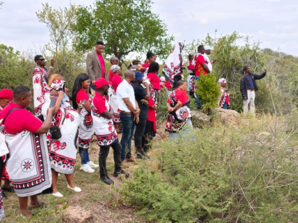
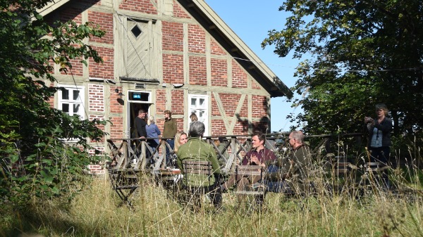
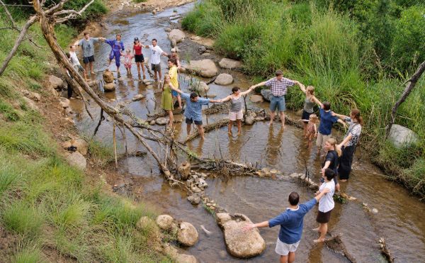
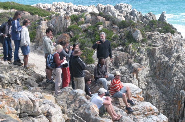
In this context, the Green Plan Studio explores how landscape architecture education can move beyond the conventional conception of isolated parks and gardens towards a more connected and equitable green infrastructure. Through observation, mapping, diagnosis and project-based experimentation across several Tunisian cities, students learn to identify existing and potential green spaces, reveal connections and develop territorial strategies. The studio thus becomes a laboratory for learning by doing, integrating theory, practice and critical reflection.
From Urban Green Spaces to Green Plans: A Shift in Tunisian Urban Planning
In Tunisia, urban green space has historically been addressed mainly through urban planning documents and programmes focused on environmental improvement and urban aesthetics (Zhioua et Turki, 2006). Within the planning system, green spaces are generally identified as specific land uses—such as public gardens, parks, planted areas associated with public facilities or roads, and recreational spaces—and are often considered through technical and quantitative requirements. This approach has traditionally relied on quantitative indicators, including the amount of green space provided per inhabitant, using the reference value of 15 m² per inhabitant adopted for new developments. While such standards have contributed to recognising the importance of green spaces in urban development, they tend to consider them primarily as individual spaces or designated surfaces rather than as parts of a wider landscape system (Zhioua, 2024).
This raises another fundamental question: what becomes invisible when green space is understood primarily as a predefined planning category? Vacant land, agricultural fragments, urban fringes, watercourses, road margins and other potentially multifunctional spaces may remain outside the conventional green-space category, even though they can contribute to ecological connectivity, climate adaptation, recreation and quality of life.
A significant shift occurred with the introduction of Tunisia’s National Plan Vert (Green Plan) Programme in 2017 (Saidane, Fekih et Rejeb, 2015; Saidane, 2022). The Green Plan was conceived as a reference and orientation document for stakeholders in urban planning and development, providing municipalities with tools to plan and manage urban space while integrating environmental, spatial, aesthetic, and social dimensions. Its scope can range from an entire urban agglomeration to a neighbourhood, making it more adaptable to different territorial contexts. In this sense, Green Plans represent a significant development in Tunisian urban planning: rather than simply creating additional green spaces, they encourage a more strategic approach to organising and managing green resources as a territorial system.
This evolution strongly resonates with the principles of green infrastructure and greenways, particularly the idea of connecting existing and potential landscape elements. The Green Plan therefore serves as an important bridge between conventional green-space planning and a more integrated understanding of the landscape as infrastructure. This shift also underpins the Green Plan Studio at Institut Supérieur Agronomique - Chott Mariem (ISA-CM), where students are introduced to landscape planning through territorial analysis, connectivity, and project-based experimentation.
The Green Plan Studio: A Pedagogical Laboratory
The Green Plan Studio is embedded within the landscape architecture curriculum at ISA-CM, where students progressively develop their ability to understand and design landscape projects through seven project-based studios spanning the engineering cycle. This progression is structured around increasing spatial scales and levels of complexity, gradually moving from the site to the territory.
In the third year, two thematic studios introduce students to landscape assessment. Through the reading and analysis of specific sites, students learn to move from observation and interpretation towards synthesis, an overarching conceptual approach (parti d’aménagement) and landscape guidelines. In the fourth year, three studios develop project skills at different scales and levels of complexity, progressing from gardens and neighbourhood spaces to urban parks and, finally, linear landscape interventions. In the fifth year, students address more complex situations through a studio focused on spaces requiring regeneration or reclamation, followed by a studio focused on planning at the municipal scale, where they explore developing a Green Plan.
The Green Plan Studio therefore marks an important transition from designing individual places to understanding the landscape as a territorial system. Students work on various Tunisian cities and engage with urban and territorial conditions rather than a single predetermined site. The objective is not simply to design more green spaces, but to explore how existing and potential landscape elements can be assembled into a coherent green infrastructure network.
As a teacher-practitioner, I integrate theoretical concepts—green infrastructure, urban ecology, resilience, and ecological connectivity—with practical approaches to landscape analysis, assessment, and design, while accounting for real-world planning constraints. The studio becomes a pedagogical laboratory where theory informs practice, practice raises new questions, and the design process becomes a means of generating knowledge (Saidane-Hamdi, 2021).
From Green Spaces to Green Infrastructure: The Studio Method
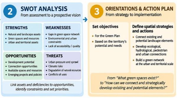
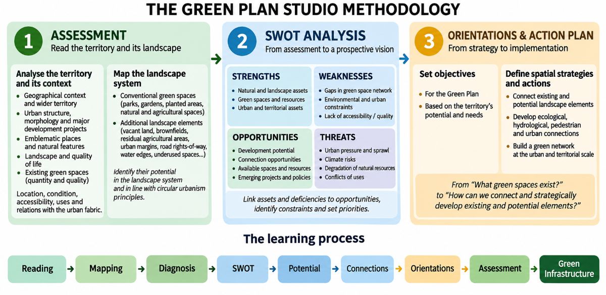
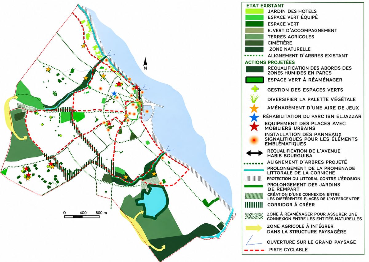
The Green Plan Studio follows a structured process that combines the Green Plan methodology with the project-based approach of landscape architecture. Rather than beginning with the design of a new green space, students first learn to understand the municipality as a landscape and territorial system. The process is organised into three main phases: landscape analysis, SWOT analysis, and the development of strategic orientations and an action plan, through which students progressively move from inventory to design proposals.
The first phase is the landscape analysis. Students begin by reading about the municipality's geographical context and its relationship with the wider territory. They analyse the urban structure, morphology and major urban development projects, as well as emblematic places and existing natural features. Landscape and quality of life are considered alongside a specific analysis of existing green spaces, both quantitative and qualitative. This landscape assessment therefore goes beyond counting green spaces: students examine their location, condition, accessibility, uses and relationships with the urban fabric.
This first reading is then expanded through mapping. Students identify not only conventional green spaces—parks, gardens, planted areas and natural or agricultural spaces—but also landscape elements often omitted from conventional green-space inventories. Vacant land, brownfields, residual agricultural areas, urban margins, road rights-of-way, water edges and other undeveloped or underused spaces are assessed for their potential contribution to the landscape system. This approach also echoes the principles of circular urbanism, which emphasise working with existing urban resources, limiting unnecessary land consumption and transforming underused spaces rather than systematically extending the urban footprint (Grisot, 2020).
The second phase is the SWOT analysis. Students identify the strengths, weaknesses, opportunities and threats affecting the municipality in relation to its geography, urban structure, landscape, natural resources and green spaces. The purpose is not merely to classify observations, but to transform the assessment into a forward-looking understanding of the territory and its wider landscape context. Existing assets and deficiencies are linked to intervention opportunities, while constraints and threats help define priorities.
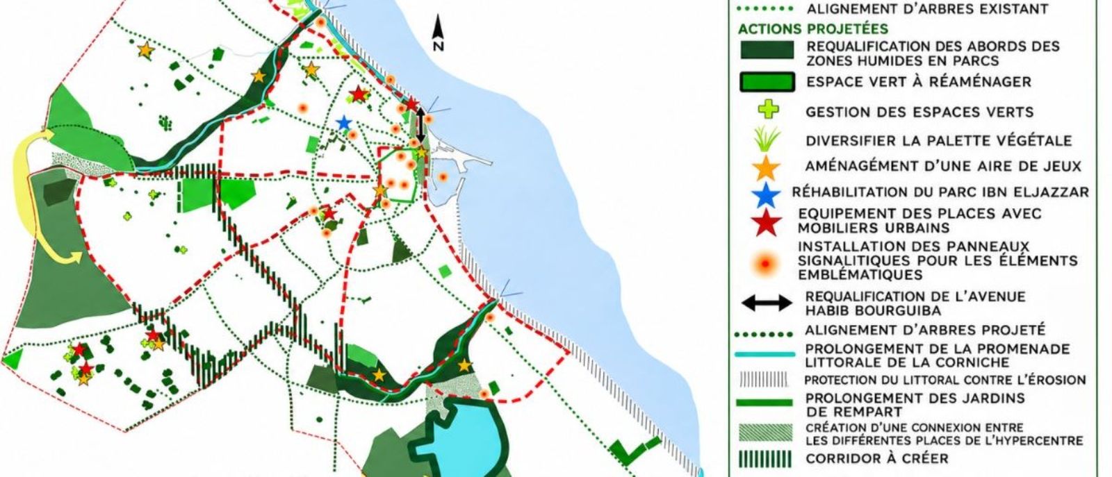
The third phase translates this analysis into strategic directions and an action plan. Students formulate objectives for the Green Plan and translate them into spatial strategies and concrete actions. At this stage, the question shifts from what green spaces exist to how existing and potential landscape elements can connect and be strategically developed. Ecological, hydrological, pedestrian and urban connections are considered as potential components of a wider green network (Clergeau, 2021).
This sequence is pedagogically important. Students do not jump directly from analysis to design. They progressively learn to recognise the potential of spaces that may initially appear disconnected, residual or insignificant, and to assemble them into a coherent territorial strategy. The Green Plan thus becomes more than an inventory or a collection of green-space projects: it becomes a framework for addressing connectivity, multifunctionality and spatial balance at the urban and territorial scales.
The final project combines a territorial vision with spatial interventions and actions, enabling students to progress from identifying landscape assets to designing a more connected and multifunctional green infrastructure network.
Learning Through Doing: Intended and Unexpected Learning Outcomes
The Green Plan Studio produces both intended learning outcomes and unexpected insights that emerge from working with real urban and territorial conditions.
The intended outcomes are closely aligned with the progressive development of landscape project skills. Students learn to read a territory at multiple scales, from the neighbourhood to the municipality and its wider geographical context. They learn to analyse interactions between natural and urban systems, including vegetation, water, soils, agriculture, urban morphology, mobility and patterns of use. Mapping is introduced not merely as a technique for representing information, but as an analytical and design tool. By layering different types of spatial data, students can identify relationships, discontinuities and opportunities for intervention. This way of interpreting the territory also draws on the landscape mosaic perspective, in which spatial patterns and relationships between patches, corridors and matrix can reveal structures and connections that are not immediately visible when spaces are considered individually (Doherty and Kotsoni, 2024). They develop the ability to recognise ecological and spatial continuities, work with territorial data, and translate diagnosis into landscape strategies. Ultimately, they learn to conceive green infrastructure as a project that connects existing resources and potential spaces rather than as a collection of isolated green areas.
However, some of the most significant learning outcomes are unexpected.
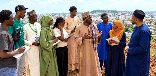
Through fieldwork and mapping, students gradually discover that the territory contains landscape resources that are not necessarily recognised within conventional planning categories. A vacant space is not necessarily devoid of value; a neglected or residual site may offer ecological, social or spatial potential.
Peri-urban agricultural land can contribute to landscape continuity, while road corridors and their margins can sometimes support ecological or pedestrian connections. Water, often treated as a constraint or a technical issue, can instead become a structuring element of the landscape project.
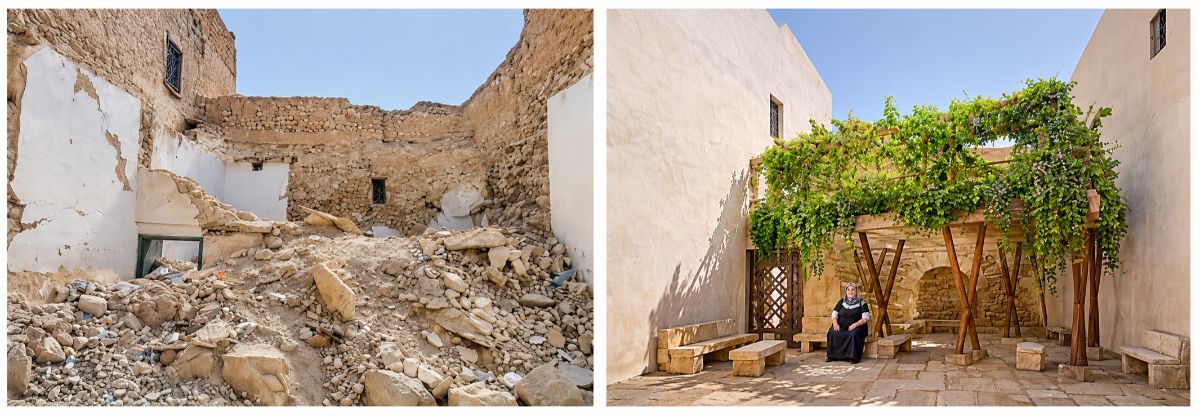
Students also begin to question the hierarchy between ordinary and remarkable landscapes. A large urban park may be important, but a series of small, modest or fragmented spaces can collectively perform significant ecological, climatic or social functions when viewed as a network. This perspective is closely linked to the concept of urban green networks (trames vertes urbaines), in which the ecological and landscape value of individual spaces is understood through their relationships and connectivity with other elements of the urban fabric (Clergeau et Blanc, 2013; Clergeau, 2021).
These discoveries reveal a deeper pedagogical transformation. The studio changes not only what students design but also what they can see. Learning by doing enables them to move from identifying predefined green spaces to recognising landscape potential, relationships and connections. In this sense, the Green Plan Studio does not simply teach students how to produce a plan; it changes the way they understand the territory on which that plan is based.
From Studio to Practice: What Can Be Transferred?
The experience suggests that the main transferable outcome is not a predefined spatial solution but a design-led methodology adaptable to diverse urban and landscape contexts. In teaching, this approach can strengthen the link between landscape analysis and design by introducing real-world data, working across multiple scales, and using green infrastructure as a planning and design framework. It prepares future landscape practitioners to work with fragmented territories, identify opportunities beyond formally programmed sites, and engage with multiple stakeholders. For municipalities, the approach can support the identification of potential green networks, the prioritisation of interventions, the recognition and enhancement of existing resources, and the integration of vacant or underused spaces into planning processes. However, implementation remains context-dependent. Land ownership, fragmented governance, maintenance capacity, financial resources, planning regulations, and implementation time may strongly influence outcomes. Moreover, Green Plans are relatively new planning instruments, and each municipality must undertake its own studies to develop a plan suited to its territory. The method is therefore transferable precisely because it does not provide ready-made solutions: it starts from each territory’s specific potentials, weaknesses and local conditions to construct context-responsive strategies.
Conclusion
The Green Plan Studio demonstrates how landscape architecture education can help rethink the relationship between green spaces, territorial planning, and urban resilience.
By moving beyond the quantitative assessment of green-space provision, the studio invites students to examine the spatial distribution, accessibility, connectivity, and multifunctionality of landscape resources. More importantly, it transforms territorial analysis into a forward-looking design process through which students learn to identify opportunities, reveal connections, and develop context-responsive strategies.
The experience also shows that learning by doing can bridge the gap between academic knowledge and the complexity of real-world contexts. Working with real data and existing urban conditions exposes students to fragmented landscapes, competing uses, institutional constraints and the uneven distribution of environmental resources. These conditions become not only challenges to address, but also material for learning and design development.
The approach is transferable to other Tunisian cities and potentially to other contexts, but not as a ready-made model or catalogue of solutions. Each municipality has its own landscape structure, resources, vulnerabilities, governance arrangements, and development dynamics, and preparing a Green Plan requires a tailored territorial study. What can be transferred is the methodology: understanding the landscape, identifying connections, and developing a vision for its future based on existing opportunities, constraints, and local conditions.
In this sense, the Green Plan Studio can be understood as a living laboratory for landscape education, where students learn not only to design green spaces, but also to view the landscape as connected territorial infrastructure and as a medium for more resilient and inclusive urban development.
References
Clergeau, P. (2021) Urbanisme et biodiversité : Vers un paysage vivant structurant le paysage urbain. Rennes : Éditions Apogée.
Clergeau, P. and Blanc, N. (2013) Trames vertes urbaines : De la recherche scientifique au projet urbain. Paris : Éditions Le Moniteur.
Doherty, G. (2017) Paradoxes of Green: Landscapes of a City-State. Berkeley: University of California Press.
Doherty, G. and Kotsoni, A. (2024) ‘Patches, Corridors, Matrix, Webs and Clouds: Expanding Richard T. T. Forman’s Land Mosaic Approach in the Medina of Tunis’, Ri-Vista: Research for Landscape Architecture, 22(1), pp. 84–101. https://doi.org/10.36253/rv-16086.
Grisot, S. (2020) Manifeste pour un urbanisme circulaire : Pour des alternatives concrètes à l’étalement de la ville. Nantes : dixit.net.
Saidane, I. (2022) ‘Natures urbaines à Carthage : tendre vers une trame verte’, Al-Sabîl : Revue d’Histoire, d’Archéologie et d’Architecture Maghrébines, 13 [online]. Available at: http://www.al-sabil.tn/?p=9177 (Accessed: 23 October 2026).
Saidane, I., Fekih, S. and Rejeb, H. (2015) ‘La trame verte en Tunisie entre réalités et perspectives’, in Rejeb, H. (ed.) Alternatives éco-paysagères dans les régions méditerranéennes. Tunis : Imprimerie Officielle de Tunisie, pp. 45–60.
Saidane-Hamdi, I. (2021) ‘The urban tree: A key element for the sustainable development of Tunisian cities’, in Rejeb, H. (ed.) Agro-Environmental Sustainability in MENA Regions. Vol. I: Agro-environmental Activities and Climate Change Impacts on Biodiversity and Crop Production. Cham: Springer.
Zhioua, I. (2024) Désir de nature dans le grand Tunis. Genève : MétisPresses.
Zhioua, I. and Turki, S.Y. (2006) ‘Les espaces verts dans le Grand Tunis, entre programmation et réalisation’, in Villes et espaces verts. Tunis : Centre de Publication Universitaire.