Integrating Fieldwork and Natural Systems in Landscape Curricula
ABout the Author/s


Dans cet article, l'auteur plaide en faveur d'une approche plus intégrée et interdisciplinaire de l'enseignement de l'environnement bâti, avec un cours fondamental sur les systèmes naturels destiné à tous les étudiants. On espère que cette approche permettra aux futurs concepteurs d'acquérir une compréhension plus approfondie des processus paysagers et des implications écologiques de leur travail, dans le contexte de la grande diversité des environnements africains et de la richesse ethnique du continent. L'article souligne l'importance du travail de terrain dans la formation en architecture paysagère, en s'appuyant sur l'expérience acquise à l'Université de Pennsylvanie et à l'Université du Cap.
In this paper the author argues for a more integrated and interdisciplinary approach to built environment education, with a foundational course in natural systems for all students. This approach, it is hoped, will equip future designers with a deeper understanding of landscape processes and the ecological implications of their work across the wide range of African environments and ethnic diversity. The paper emphasises the importance of fieldwork in landscape architecture education, drawing from experience at the University of Pennsylvania and the University of Cape Town.
Philosophical Beginnings
The pedagogical philosophy explored in this paper has notable comparisons with that of Graham Young’s ‘Landscape through Experience’ piece in this issue of the journal. Both papers reference early landscape educational influences rooted in ‘learning through landscapes’, the current theme of the Journal.
Whereas Young’s experiential approach is based on the Toronto School of landscape architecture, as well as the influential work of Lawrence Halprin, my own approach has been influenced from studying at the University of Pennsylvania (Penn) School and by the ecological planning method of Ian McHarg’s ‘Design with Nature’ (1969). These two approaches have important similarities, with an emphasis on ‘knowing the land’, particularly through fieldwork. Part of our challenge in teaching students has been to adapt these models to the African context.
Interestingly, McHarg was influenced in the early years at Penn by the pioneering South African ecologist Dr John Phillips (1899-1987), who had vast experience in African ecosystems and agricultural systems, and who brought a rigorous scientific approach to the Penn landscape course. Both McHarg and Phillips believed that the priority for dealing with environmental and land use planning issues lay at the regional scale, and that the site scale was a microcosm of broad-scale ecological systems.
It was therefore no surprise that as students (of McHarg) we were exposed during the first semester to geology, pedology, hydrology, limnology, ecology and climatology, followed in the second semester by human ecology and anthropology. It was a transformative experience for those of us who came from an architectural school background with little understanding of landscape context and social systems.
Teaching and Practice through Fieldwork
The Penn course placed a great deal of emphasis on fieldwork in order to understand why a particular landscape looks like it does, comprising an inherent logic, and how people and settlements have responded to a particular landscape. It was not unusual as students to spend a Saturday waist-deep in a New Jersey salt marsh having the food chain explained to us by the ecology lecturer, or to observe the difference between the native American's response to a dynamic coastal environment compared to that of modern indiscriminate forms of development.
This background equipped me over several decades of practice to make fieldwork an essential part of any project and of my teaching. Instead of asking specialists, such as a geologist or soil scientist to send me their report, we would walk the site together so that I could understand the evolution of the landscape, the dip angle of formations, faults and joint patterns, sources of water and much more. These patterns would be mapped to became indispensable informants for the site development plan.
A list of plant species sent to one by the botanist is of limited use to the landscape planner. Instead one would walk the site with the botanist or ecologist to understand why certain plants grow together, how plants are indicators of site conditions, and observe that vegetation types are a response to the geological substrate, in so doing understand the intricate correlations within landscape systems.
An archaeological survey would be inconceivable without fieldwork, along with the assistance of the indigenous inhabitants, anthropologists and heritage specialists, in order to understand the cultural layers of the landscape. While working on a project in Costa Rica, we did not merely fly in and fly out but remained for several months to get to know the place and the people, involving local students in the mapping.
Gareth Doherty (2025) discusses this approach at length in his book on 'Landscape Fieldwork', where he states that landscape fieldwork allows us to engage our body and immerse our spirit to critically understand a landscape and its future possibilities. In his words:
"... landscape fieldwork heightens our critical awareness. It helps us to understand whether a project is necessary or can be built in another way".
Reading the Landscape
The focus of the Terrain Analysis course that I gave at the University of Cape Town (UCT), which prompted my 'Reading the Landscape' notebook (2014), was to understand the implications of natural systems for landscape planning purposes.
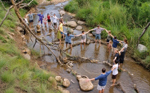
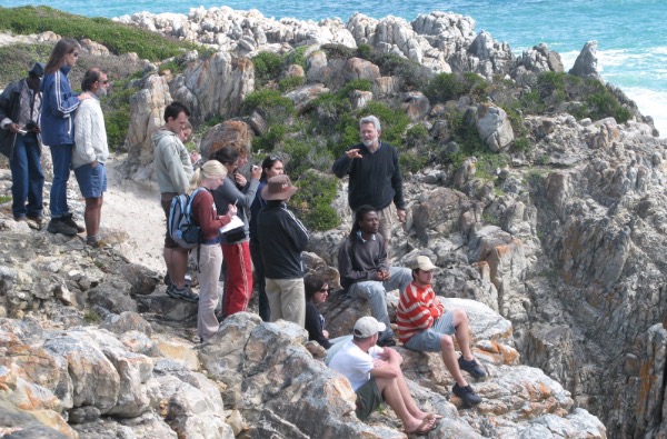
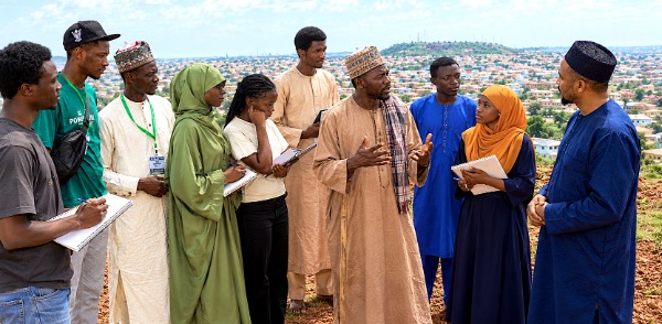
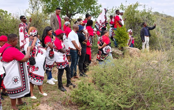
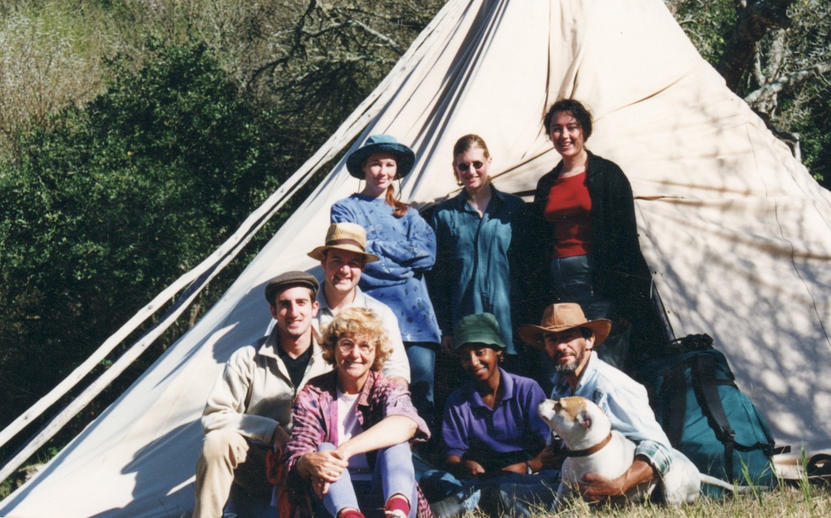
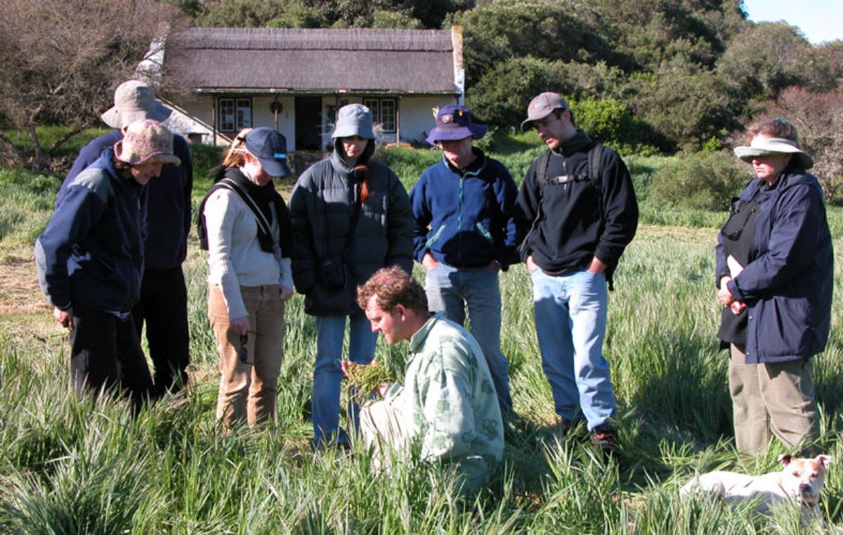
The course involved a number of field trips, the main one being the ecology camp over several days in the company of a geologist, botanist and one or two others. It was revealing to see how the students, including a few final-year architecture students, grasped the interrelationships between the various landscape features through fieldwork (Figures 1 and 2). Students were encouraged to explore the following key questions:
- Why does the landscape look like it does?
- How do landscape processes inform planning and design?
- How well have land uses and human settlements responded to these processes?
- What guidelines flow from this understanding for future, more sustainable development?
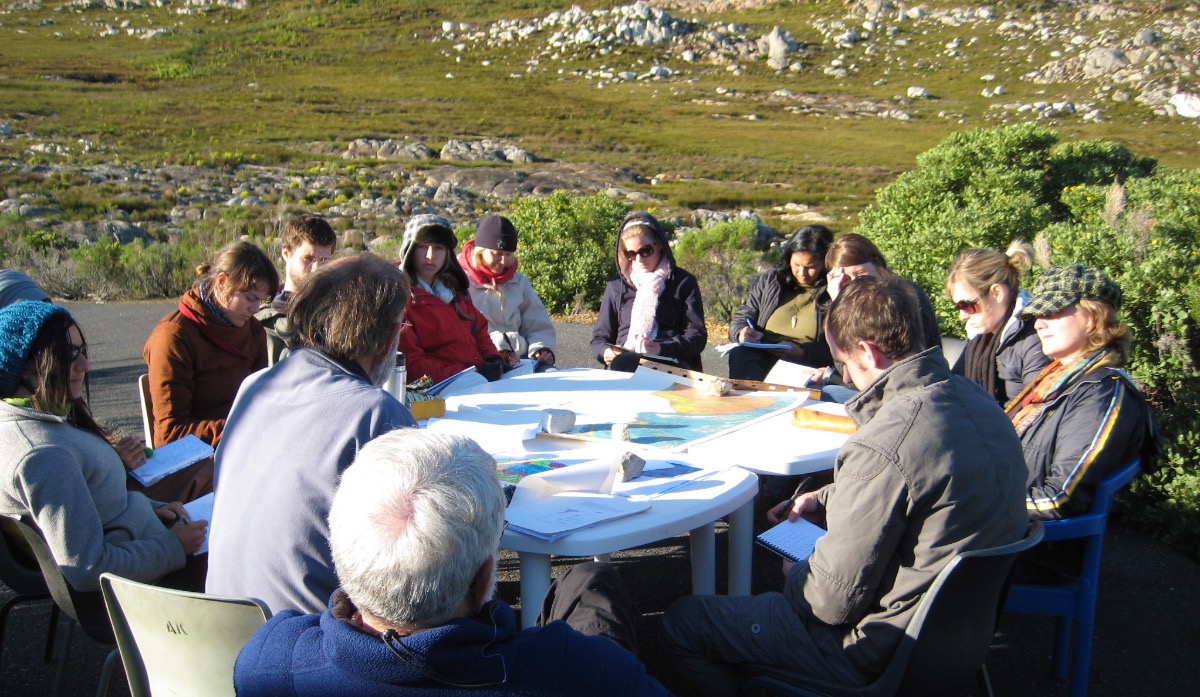
Every lecture or field trip would be followed by a practical on the same topic so that the relevance of the theory was immediately clear to the student. This approach does not seem to be employed often enough in the design of curricula.
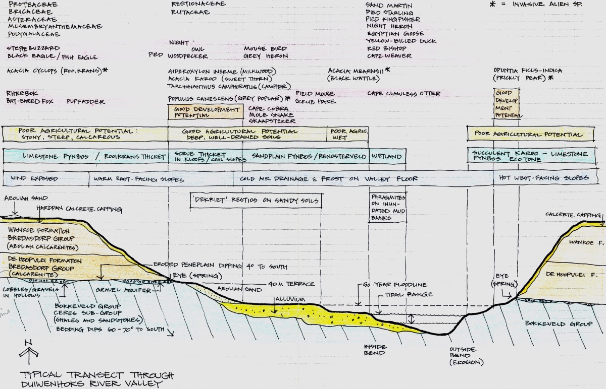
My experience has been that typical cross-sections through the study area were essential to develop a deeper understanding of how the landscape works (Figure 4). Doherty (2014) also notes that sections through a hillside can help to understand topography, soils, hydrology and geology as well as movements of people (and animals) in space and time.
The Curriculum Conundrum
With the background above in mind, I have come to another conclusion – the current education of students in the built environment professions tends to be back-to-front. For example, in many cases one has to first study architecture to be accepted in a masters programme in landscape architecture or planning in South Africa. This is a contradiction, as ecology has taught us to think in holistic terms, i.e. to understand natural systems at the broad landscape scale before working at the site scale or on the design of buildings, in order to understand the context.
The evidence for this conundrum is in the projects by architecture or town planning students, where there is little reference or understanding of the natural features, ecological functioning or environmental planning constraints of their study area, which became clear to me some years ago while viewing thesis year architectural projects at the University of Cape Town.
To avoid design taking place in an environmental vacuum, a basic training in natural and social systems needs to form part of the curriculum for all those involved in the built environment professions. It should be the foundation course for all the other courses leading to architecture, landscape architecture, engineering, urban design and city planning. It is after all irresponsible to prepare plans without some understanding of broader landscape processes, and the possible consequences of one’s projects in relation to the ecological functioning of landscapes and their inhabitants. To quote Simon Bell (2012):
“the design needs to be grounded in the accumulated knowledge of how the landscape works”.
The current problem is that the various degree courses at university level relating to the built environment function far too much as separate entities, when in fact there should be more overlap in the design of their curricula.
Environmental Planning Tools
The earlier laborious task of creating overlay maps on a light table using colour felt pens has gradually been replaced by geographical information systems (GIS) software, which enables spatial data to be far more efficiently stored and retrieved, as well as combined in myriad ways by asking relevant questions. On the downside, I sense that we have lost the more tactile relationship of manual mapping.
Google Earth satellite imagery, often used in combination with GIS, has provided a valuable earth sensing tool to aid environmental planning, or the use of Geodesign that combines geographic information with impact simulations to test alternative design scenarios and solve complex spatial problems. My experience, however, is that GIS mapping is often performed by technicians who do not necessarily have an understanding of landscape systems.
The crunching of data can be a time-consuming exercise and should not replace experiencing the site first hand and ‘reading’ the nuances of the landscape and the local community. No doubt artificial intelligence (AI) will result in increasingly sophisticated tools, while human intelligence (HI) will continue to play a significant role. The risk is that AIcould separate us even further from experiencing our environment.
Conclusion
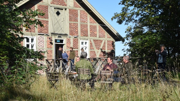
I have argued here that fieldwork plays an indispensable role in the training of landscape architects, particularly in an era where computers and digital devices consume so much of our lives. When I meet students from the past, they seem to mostly remember the ecology camp, which should tell us something about how students learn. (Figures 5 and 6).
It is also argued here that a re-organisation of current curricula, including the breaking down of professional silos, towards a much more integrated and interdisciplinary approach to planning and design is required, the foundation of the curriculum being an introduction to natural and social systems and their implications for planning and design. The many fledgling landscape courses being established on the African continent have an opportunity to facilitate this approach in their curricula.
In South Africa, the proposed unified Board of the Built Environment, under which the various disciplines, such as architecture, landscape architecture and engineering, would have their own 'Boards' could have the potential to achieve a more interdisciplinary approach if structured with this in mind.
Van der Ryn and Cowan, in their book on Ecological Design (1996), propose that the design studio be a venue for teaching ecological design involving real problems and real people, allowing students to learn in a cooperative, interdisciplinary way. The authors stress that:
"ecological design cuts through the insularity of the various design professions”.
In an IFLA symposium paper (2011), I commented that "The essence of working in Africa as a landscape architect is that one is constantly at the coal face, dealing with core issues of survival, sustainability and conservation, as well as routine site design".
This has a bearing on the training of landscape architects in Africa. Additionally, it has a bearing on the training of all those involved in the built environment.
References
Bell, S. 2012. Landscape Pattern, Perception and Process. Routledge.
Doherty, G. 2025. Landscape Fieldwork. University of Virginia Press.
McHarg, I. 1969. Design with Nature. Natural History Press.
Oberholzer, B. 2011. Reading the Landscape: Reflections on Teaching in the Landscape Architecture Programme at UCT. IFLA 2011 Symposium, Nairobi, Kenya.
Oberholzer, B. 2014. Reading the Landscape Notebook. Landscape Notebooks.
Van der Ryn, S. and Cowan, S. 1996. Ecological Design. Island Press.