
African Landscape Network: Project Spotlight
ABout the Author/s
This month, we feature the Cape Floral Region Protected Areas, South Africa.
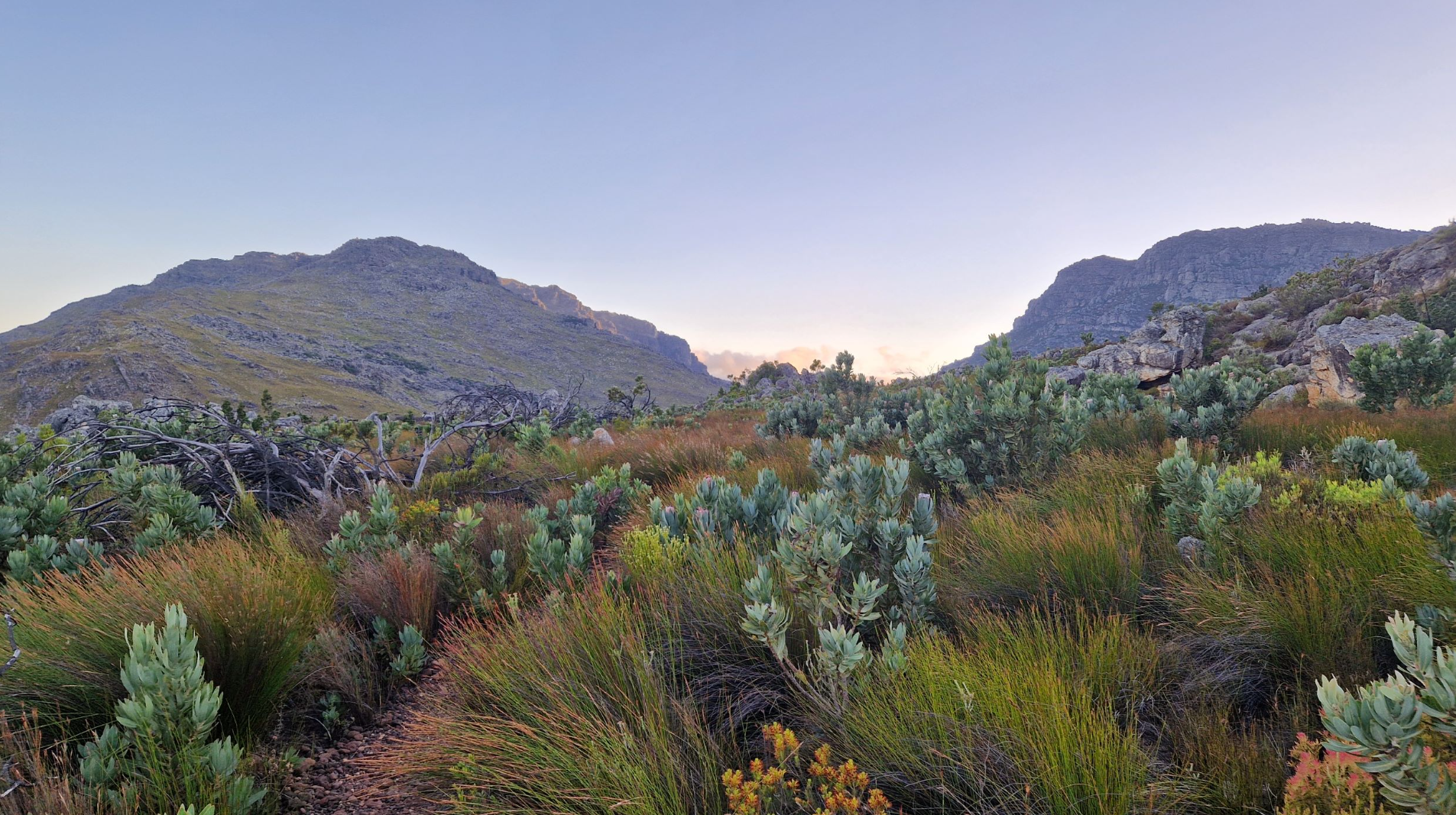
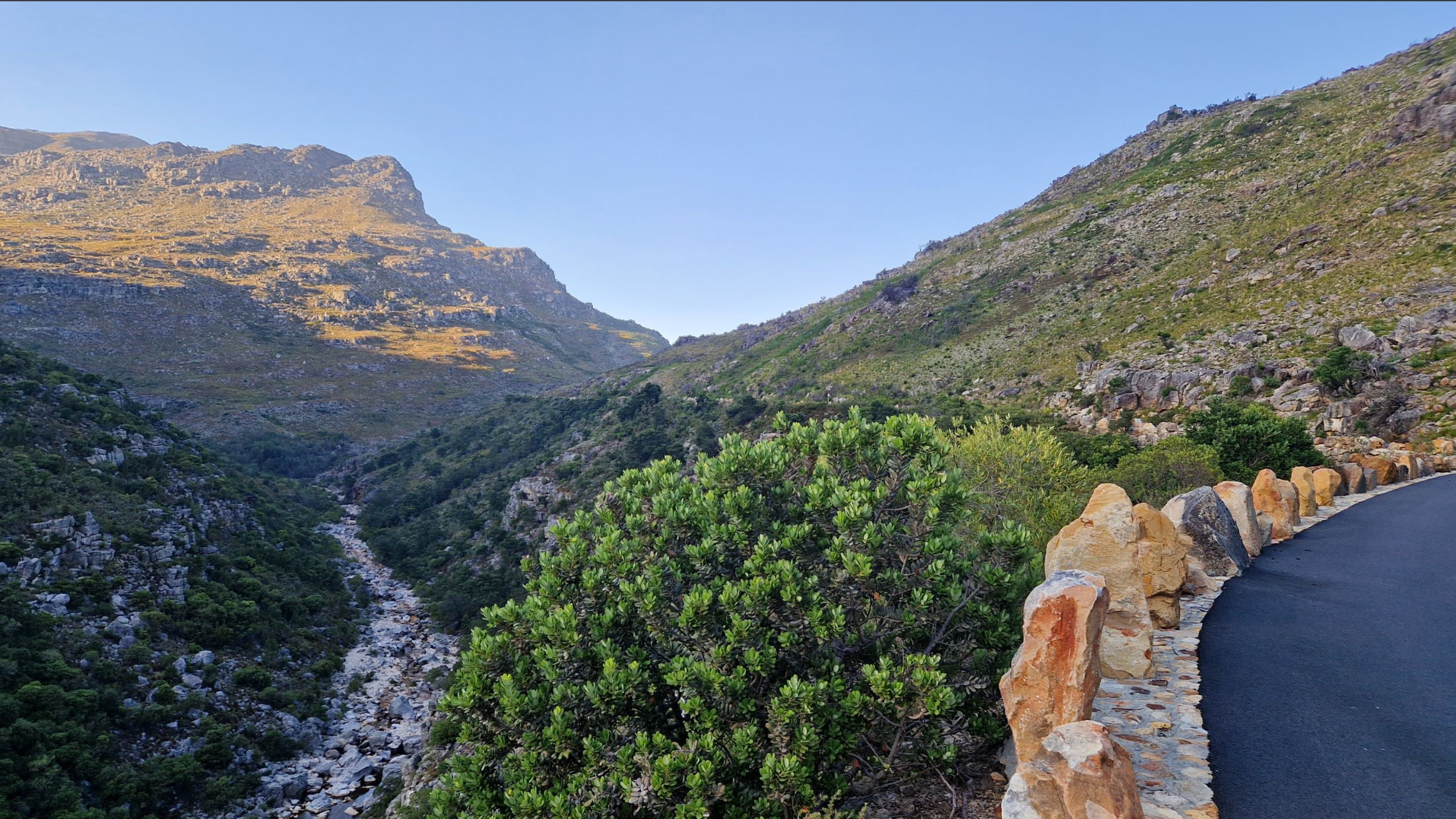
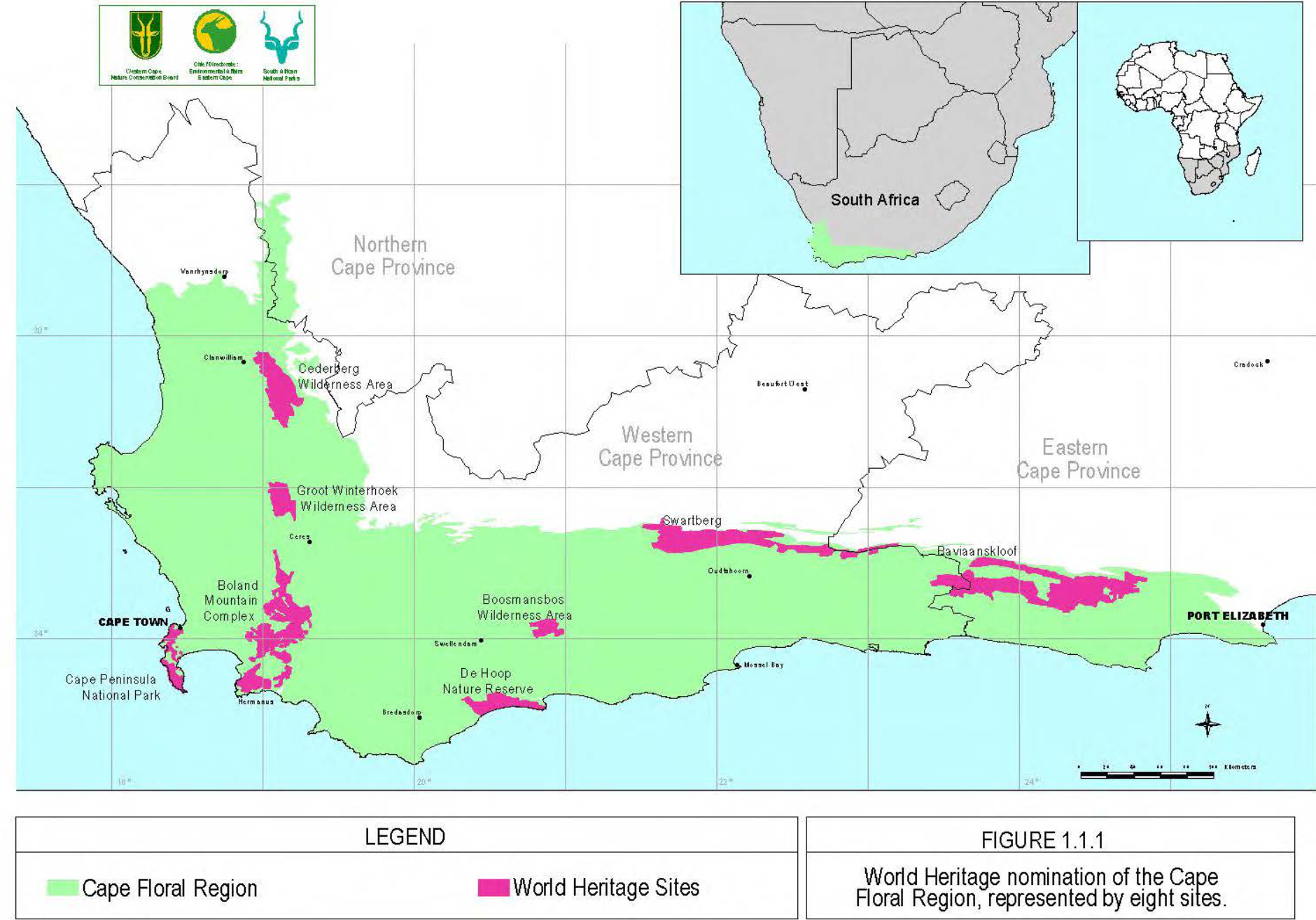
Recognised as one of the most remarkable places for plant life on Earth, the Cape Floral Region is a botanical constellation of extraordinary richness. Covering more than one million hectares, this serial World Heritage property comprises 13 protected area clusters representing a highly distinctive phytogeographic unit. It is one of only six Floral Kingdoms globally and, despite being the smallest, it is among the most diverse. Its famed Fynbos vegetation, found nowhere else in the world, supports an exceptional density of endemic and threatened plant species and reflects ongoing ecological and evolutionary processes of global significance.
Originally inscribed in 2004, the property includes coastal landscapes, mountain catchments, wilderness areas, parks, and restoration zones. Managed collaboratively by SANParks, CapeNature, and the Eastern Cape Parks and Tourism Agency under the coordination of the national Department of Environmental Affairs, the site demonstrates a layered governance model rooted in partnership. While site-specific management plans guide individual clusters, continued progress toward a property-wide Environmental Management Framework remains an important step for integrated stewardship.
The Cape Floral Region embodies the principles of the African Landscape Convention. It acknowledges the responsibility to nurture landscape health through conservation, restoration, and sustainable resource use. The management approach recognises that landscape shapes identity and culture at regional scale, while encouraging participatory planning and long-term resilience. Manual invasive species control programmes and adaptive fire management strategies offer transferable models for ecosystem-based management across Africa. At the same time, buffering mechanisms, ecological corridors, and stewardship initiatives strengthen connectivity and climate resilience across privately and publicly managed lands.
Supporting the Sustainable Development Goals, particularly Goal 3 (Good Health and Well-being), Goal 15 (Life on Land), and Goal 17 (Partnerships for the Goals), the property integrates biodiversity conservation with poverty alleviation, public awareness, and collaborative governance. Climate change, invasive alien species, and development pressures remain ongoing challenges, yet these are addressed through strategic planning and cross-sector partnerships designed to safeguard long-term ecological integrity.
Entry is made by Marike Franklin on behalf of the project team to celebrate this extraordinary African cultural and natural landscape within the ALN composite map. Extracts of information are drawn directly from the UNESCO World Heritage Centre.
We encourage Member Associations to invite individuals within their organisations to submit their profiles and projects to the online map platform. Beyond advancing the aims of the African Landscape Convention and documenting landscape initiatives across the continent, the ALN increases international visibility and serves as an educational resource for students and practitioners alike. To submit your profile or project, please visit the website. Submitted profiles may also be shared across our social media platforms to further expand reach and engagement.
